


Our Work
From Vision to Legacy
Blue Green Infrastructure partners with water sector entrepreneurs, impact investors and development agencies to structure blended finance schemes and market-based approaches to execute water, wastewater, drainage and reuse investment projects. The firm provides transaction advisory, technical due diligence, market studies and consulting services to design and implement impact monitoring processes and systems.
Founders
Expertise dedicated to accomplish a shared vision

Carlos Aguilar
PrincipalCo-Founder. Head of Project Development

Diana Aguilar
Lead ArchitectCo-Founder. Head of Design
Projects
Our team works on multiple projects and programs. Our current geographic focus is Mexico and Guatemala.
Rivers Stewardship in Naucalpan, Mexico
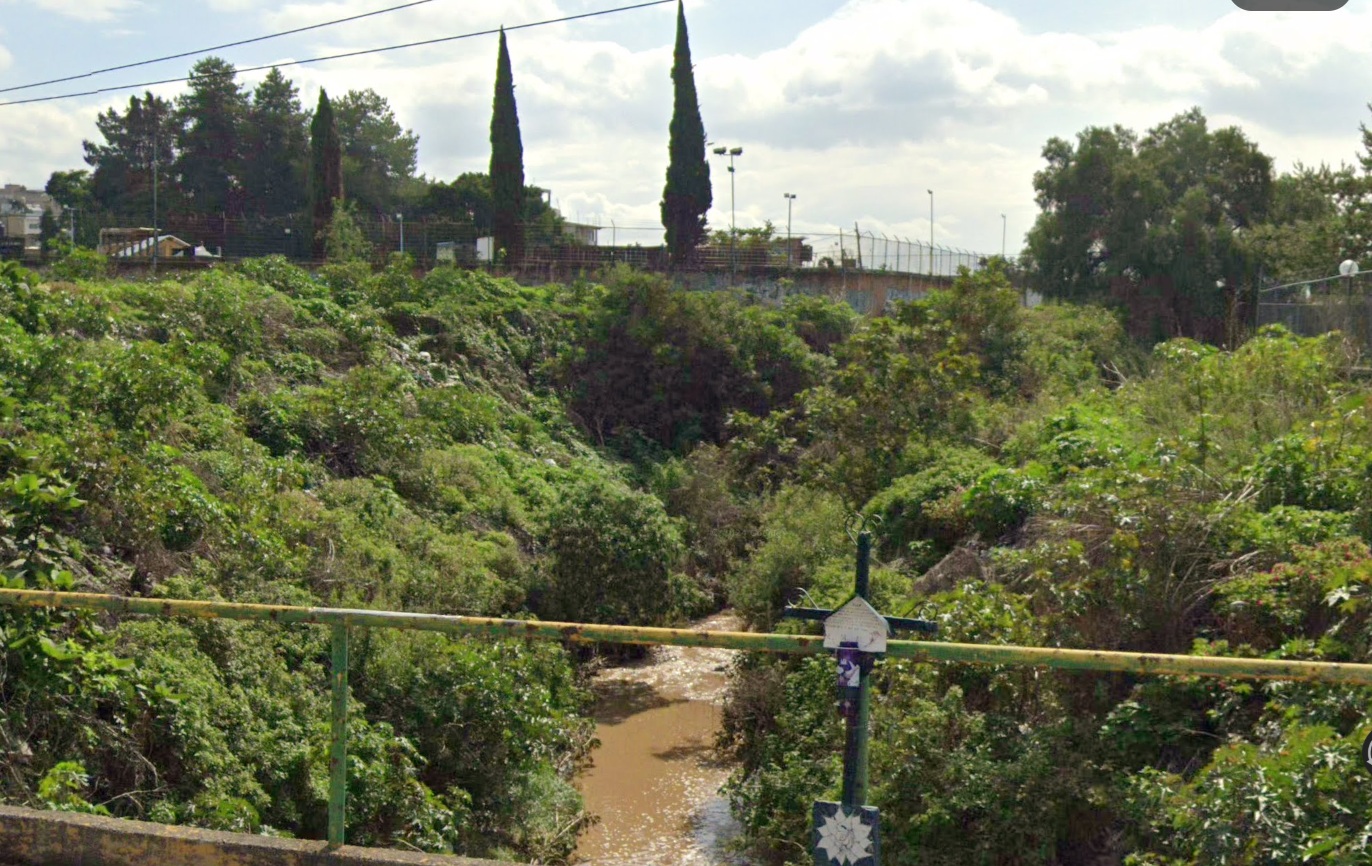
Naucalpan is home to six environmentally protected areas, such as Los Remedios National Park and the Naucalpan Metropolitan Park. The region also features significant water bodies, including the Madín Dam (Presa Madín), a crucial reservoir for industrial, agricultural, and drinking water supply. However, it faces environmental threats like acid rain, illegal wastewater discharge, and solid waste contamination. Another important waterway is the Hondo River (Río Hondo), a 17-kilometer intermittent tributary that has been turned into an open sewage channel, posing flood risks and health hazards for nearby communities. Naucalpan has at least 268 informal settlements, housing approximately 9,000 families, many of whom reside along the banks of the Hondo River.
Many of these waterways are intermittent or seasonal, especially in dry periods. - Several, like Río Hondo and Río de los Remedios, suffer from severe pollution due to wastewater discharge and urban encroachment. Some sections have been channeled or covered due to urban expansion.
The main rivers and canals that cross the Municipality of Naucalpan, State of Mexico, along with their approximate lengths are:
1. Río Hondo – 17 km (intermittent, heavily polluted)
2. Río de los Remedios – ~12 km (partially channeled, crosses urban areas)
3. Río San Lorenzo – ~10 km (tributary of Río Hondo, seasonal flow)
4. Río Chico de los Remedios – ~8 km (smaller branch of Río de los Remedios)
5. Canal de Chalmita – ~6 km (artificial drainage channel)
6. Canal Nacional (Tramo Naucalpan) – ~5 km (historic canal, now mostly urbanized)
7. Arroyo Totolica – ~4 km (seasonal stream in western Naucalpan)
8. Arroyo San Francisco – ~3 km (small tributary in northern areas)
Rivers lenght in the Municipality of Naucalpan: 57km